
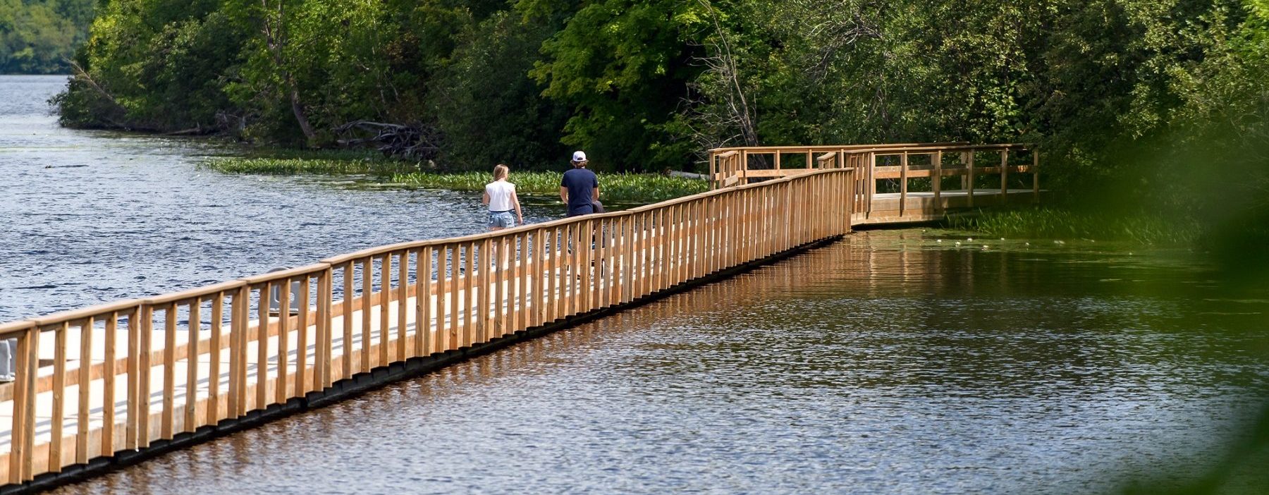


Discover Muskoka on Two Wheels

Did you know that Muskoka is a regular stop on the Ironman cycling circuits, Spin the Lakes Tour and Northern Pass to Conquer Cancer?
And there’s a reason for that – Muskoka’s stunning lakeside views, picturesque countryside, and fresh northern air makes it one of Ontario’s top cycling destinations. Additionally, Muskoka’s various towns are cyclist-friendly and cater to cyclists’ various needs, including offering bike repair and equipment stores, route information, and the chance to refuel at local restaurants.
Read on to learn more about cycling routes currently operating in Muskoka.
Algonquin Park Cycling Route

Old Railway Bike Trail: No other trail offers the same easy-riding experience as Algonquin Park’s Old Railway Bike Trail. Pedal for up to 34 kilometres past scenic views and watch for wildlife and birds. Learn more
Minnesing Mountain Bike Trail:
The Minnesing Mountain Bike Trail is a steep, rugged mountain bike trail consisting of hilly, sometimes muddy, terrain filled with rock, roots and obstacles unsuitable for small children and unfit adults.
This trail is intended for experienced mountain bikers only. Hazardous sections containing mud, sand/soft soil, exposed roots, and rocky uphill and downhill terrain exist throughout the trail. The use of a helmet is recommended and caution be taken to avoid injury and equipment damage. Park visitors using this trail do so at their own risk.
Various trail loops from 4.7 to 32.2 km in length. Learn more
Huntsville Cycling Routes

Old Ferguson Road: Starting and ending in Huntsville, the Old Ferguson Road Cycling Route is a 14 km ride and is considered an easier track. This route has a total ascent of 75 m. It is well-paved and has beautiful views of Lake Vernon and Huntsville’s exposed rock. This route is a great option for beginners and anyone getting back into cycling again. MAP
Fairy Vista Trail: Escape into nature and explore the enchanting Fairy Vista Trail, a scenic all-season trail that winds through fields, forests, and wetlands. This trail is perfect for all types of recreational activities, with the exception of motorized vehicles, allowing you to fully immerse yourself in the serene natural surroundings. Located off Hwy #60 a turn onto Fairyview Drive will take you straight to the Fairy Vista Trail. The trail is easily accessible and offers a moderate level of difficulty, making it suitable for a variety of skill levels. The 3.4km paved trail is also animal-friendly, allowing you to bring your furry friends along for the adventure. As you hike along the trail, you’ll be treated to picturesque views, and you can take breaks at conveniently placed benches along the way. Parking options are available, either at designated lots or roadside, making it convenient for visitors. MAP
Huntsville Mountain Bike Association: Is a non-profit organization founded to promote mountain biking in the community, as well as protect and develop a sustainable trail network in Huntsville. HMBA runs weekly cycling events such as the Thursday night race series, kids skills nights and Tuesday night group rides. To participate in group rides, make sure that you get an HMBA membership or a one-day pass. HMBA also hosts a variety of impromptu and local events, so be sure to visit their website or social media for more information.
The Huntsville Mountain Biking Association works with community partners to build and maintain a network of trails in and around Huntsville. HMBA Manages Trails at Hidden Valley, Deerhurst, and Lance’s Loops. HMBA makes mountain biking safe, accessible and fun for everyone! Learn more
Arrowhead Provincial Park: At this year-round park in the heart of Muskoka, hike or bicycle on trails that wind through maple forests and past waterfalls, beaver ponds and homesteaders’ farms. Quiet Arrowhead and Mayflower Lakes and the meandering Little and Big East Rivers, are ideal for paddling, fishing and swimming.
Arrowhead has two moderately challenging mountain bike trails – the 4.5 km Arrowhead Lake Trail and the 3 km Lookout Trail. Bike rentals are available onsite. Learn more
Lake of Bays Cycling Routes

Lake of Bays Loop: Starting and ending in Dwight, this one is a big one! Lake of Bays Loop is a 73 km route that takes you around one of Muskoka’s famous lakes, passing through Dorset, Baysville and Dwight. While in Dorset, you can turn right off of Hwy 35 onto Dorset Scenic Tower Rd to see one of Muskoka’s best lookouts. This route has a total ascent of 399 m. MAP
Limberlost: “Lost in the Woods” Trail. This is one of our favorites. It is scenic, with lots of rolling hills and lake views. Might even see some wildlife. Smooth turns make this an enjoyable ride. This route is 69 km long with a total ascent of 261 m. The turndown Fielddale is optional, but the road is newly paved (except for one short section that has a couple of rough patches, but the scenery makes up for it). Park in the parking lot beside the fire hall to start your ride. MAP
Echo Valley Nature & Bike Trails: If you are looking for wildlife in a fast-paced mountain bike trail ride it is our hope you will find everything you are looking for at Echo Valley Nature & Bike Trails. There are a total of over 3.5 km of trails consisting of the main trunk line and 14 smaller trails with varying degrees of difficulty. The park is approximately 24 hectares (60 acres) in size and there is a viewing platform overlooking the protected land. The access point to the trail is a turn on Echo Hills Rd off Hwy 60. Some of the features & amenities of this trail are free parking, an observation deck, and scenic views. The trail has an easy difficulty rating. MAP
Bracebridge Cycling Routes

Bracebridge Waterfalls Route: Starting in and ending in Bracebridge, this 27 km route takes you through charming downtown Bracebridge with views of three spectacular waterfalls; Bracebridge Falls, Muskoka Falls, and High Falls. You will also experience the beauty of nature Bracebridge has to offer as there is plenty of exposed rock and untouched forest to be explored. You also might get a chance to see the abundance of wildlife Muskoka has on your ride. The total ascent of this route is 85 m. MAP
Bracebridge – Milford Bay: If you’re looking for an unforgettable cycling experience, the 55km track starting and ending in Bracebridge is a must-ride.The scenery along the route is breathtaking, with winding roads, stunning lakeside views, and picturesque towns to explore. With so much to see and do, this cycling route in Muskoka is perfect for both seasoned cyclists and beginners alike. Don’t miss out on this incredible adventure. The total ascent of this route is 151 m. MAP
Liv Outside: When you rent a mountain bike you have access to their 6km trail. It starts off easy and becomes more complex as you progress. They also have road bikes, city bikes and e-bikes. They recommend biking down Santa’s Village Road and Golden Beach Road which run parallel to the Muskoka River. Learn more
Bracebridge Resource Management Centre: Immerse yourself in the natural beauty of Bracebridge Resource Management Centre, a hidden gem for outdoor enthusiasts. Located along the picturesque Muskoka River, this Centre offers a variety of recreational activities including groomed cross-country skiing, snowshoeing, hiking, and mountain biking trails, perfect for all seasons. Map
Muskoka Guided E-Bike Tours: Experience the downtown Bracebridge Waterfalls and Parks Tour. Stops include multiple waterfalls, photo spots, lookouts, and historic landmarks. The cost is $90 per rider for a two-hour tour. Tours can be booked online at muskokaebike.com. Guests must be 16+ to ride.
Gravenhurst Cycling Routes
Muskoka Wharf 1: Starting and ending on the spectacular Muskoka Wharf in Gravenhurst, this 55 km track takes you through the Muskoka countryside and a number of small hamlets. Before you pass over HWY 11, turn right on Morrow Dr to catch a glimpse of Muskoka Falls. Also, Muskoka Beach Rd, a 10km stretch near the start of the route is a local favourite so go check it out. This route is great because it is a well-paved road and after you finish your smooth ride you can check out the fantastic shops before cooling off in beautiful Lake Muskoka. The total ascent of this route is 134 m. MAP
Muskoka Wharf 2: Starting and ending near the spectacular Muskoka Wharf in Gravenhurst, this 107 km loop will test your endurance. It passes by a number of lakes and waterways, giving you great views of the water and the surrounding countryside. The ride from Gravenhurst to Torrance is on the shoulder of a well-paved but generally busy road. You need to cross Hwy 11 to get across the Severn River. Otherwise, all back roads and the road from Torrance south to Severn River are fabulous! The total ascent for this route is 156 km.
Muskoka Lakes Cycling Routes

Bala Route: Starting and ending in the beautiful town of Bala, Ontario’s cranberry capital, this 95 km track will test your strength and endurance with two significant climbs. Be sure to stop in Port Carling and admire ‘The Wall’, the world’s largest picture mosaic. You might come across the village moose near Windermere on this route. This route is for intermediate riders but if you are looking for a challenge there are places along this route you can take breaks to make the ride fit your endurance level. The route is well-paved but busy at times. It has a total ascent of 422 m. MAP
Windermere Route: Starting and ending in the charming village of Windermere, this 63 km track takes you around the spectacular Muskoka countryside. You will see rolling hills, farmland and barns, a rarity in these parts, finishing off with views of beautiful Lake Rosseau. This route is well-paved and the ride has a total ascent of 197 m. MAP
Torrance Barrens: The Torrance Barrens was designated as the world’s first permanent Dark Sky Reserve in 1999. The landscape features low ridges of Precambrian bedrock, separated by wetland and peat-filled hollows, giving it a lunar appearance. The Barrens is an excellent location for stargazing and also offers three well-marked trails for hiking and mountain biking. MAP
Georgian Bay Cycling Routes
Port Severn Big Chute: The Port Severn Big Chute Loop is a 64.62 km rural ride featuring rolling hills and scenic views. Starting and ending in Port Severn, this ride has a little bit of everything and is a popular Georgian Bay route. This route has a total ascent of 112 m. MAP
Stewart Lake MacTier: The Stewart Lake Short Ride begins in MacTier and makes its way around the shorelines of beautiful Lake Joseph before returning to the picturesque views of Stewart Lake. This route has a total ascent of 38.13 m. The route has lots to offer as it has good road quality, stunning views and great places to stop for a bite to eat in MacTier after your ride. MAP
Georgian Bay Island National Park: Bicycling is a great way to help you cover more ground when exploring Beausoleil Island. The Huron, Christian and Georgian trails are open for cycling. The Huron and Christian trails offer a very pleasant ride through mature forest, while the Georgian trail is a more difficult challenge with technical, rocky sections. Learn more
Six Mile Lake Provincial Park: Six Mile Lake Provincial Park is easily accessible off Hwy 400 in Georgian Bay Township. Only 90 minutes from Toronto, this popular park is a world away from the hustle and bustle of the city. Learn more
Stay and Play
Make the most of your Muskoka experience and check out our top recommendations for places to stay and perfect getaway packages.