Come Tour the Best Fall Colour Roads
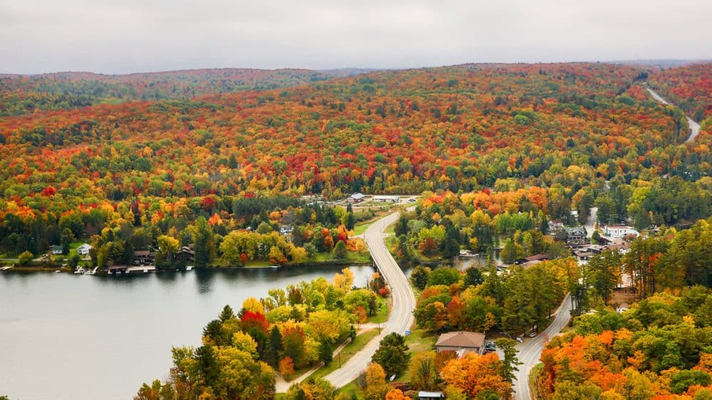
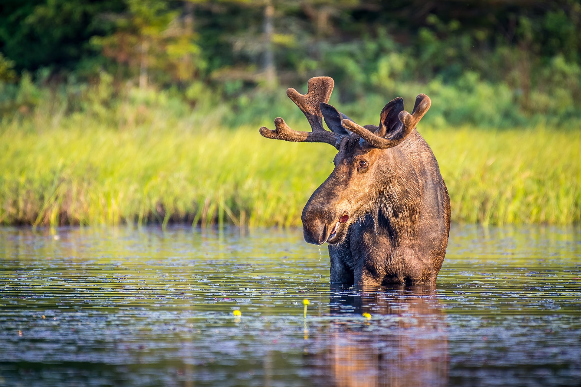
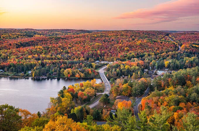
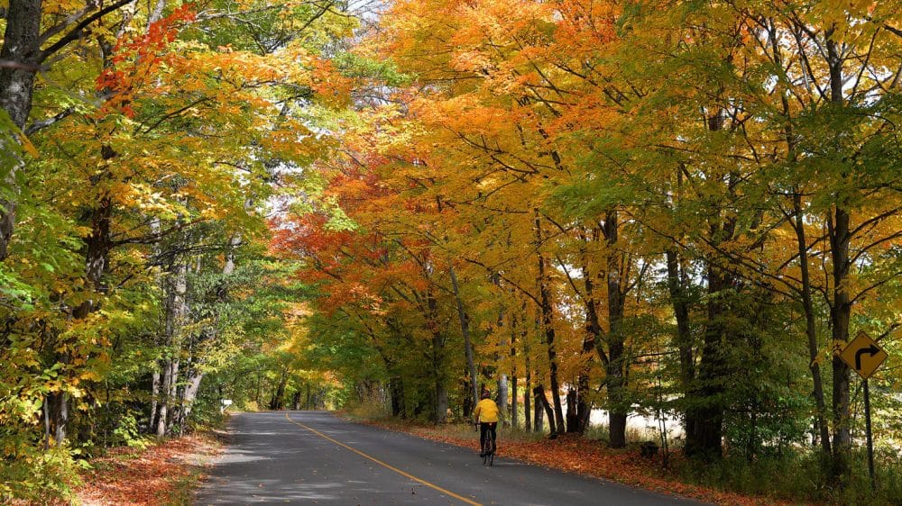
Nothing can compare to a relaxing drive during the colourful fall season, and there is no better place to hit the road than in Muskoka, recently named the best place in Canada to view fall colours by Huffington Post. You will be in awe of the oranges, yellows, and fiery reds that are bursting at every turn in the road, and the thousands of lakes across Muskoka only add to the allure. Pack your bags, hop in the vehicle, and hit a number of these open roads in Muskoka to see the fall colours at their absolute best!
White’s Falls Road (Muskoka Road 34)
Georgian Bay Township
Take the exit off of Hwy 400 for White’s Falls Road, and head east. This tight road has some great turns, beautiful rock outcroppings, and a great variety of marshland, forest, and colourful leaves. Take the road all the way to the Big Chute Marine Railway, and watch this engineering marvel at work! Click here for a map of Georgian Bay Township’s top driving roads
Hwy 141 between Utterson and Rosseau
Muskoka Lakes
This road was meant for a fall cruise. Picturesque colours and views surround, as you wind along the edges of stunning Lake Rosseau and beautiful Skeleton Lake. Click here for a map of Muskoka Lakes’ top driving roads
Santa’s Village Road / Golden Beach Road
Bracebridge
Follow the bend of the Muskoka River through a beautiful area of Bracebridge where you will see fall’s colours and folks enjoying a last boat ride. Santa’s Village Road leads to the iconic Santa’s Village which is open 7 days a week in the summer months and on weekends into October. Dip your toes into Lake Muskoka at Bowyer’s Beach before heading back out on Golden Beach Road. Click here for a map of Bracebridge’s top driving roads
South Limberlost Road
Lake of Bays
Experience the stunning beauty of autumn in North Muskoka on this scenic route off the beaten path. Drive underneath a brilliant canopy of colourful leaves that will ignite the senses as you travel past several small lakes, Limberlost Forest and Wildlife Reserve, and J. Albert Bauer Provincial Park. Grab some sweets and coffee from Erika’s Bakery in Dwight before venturing out for this picturesque tour. Click here for a map of Lake of Bays’ top driving roads
Muskoka Road 10
Huntsville
Start on Muskoka Road 10 by exiting off of Highway 11, and head towards Port Sydney. Slow down as you approach the village, taking in the colours of Mary Lake, and the Port Sydney Chute on the Muskoka River. Continue on towards Huntsville. This stretch of road is maple syrup country, so you will notice a lot of red, vibrant sugar maples! When you reach Brunel Road, turn left towards Huntsville. Stop in at Whimsical Bakery for a sweet treat and take a relaxing walk of charming Downtown Huntsville, checking out the shops and sights. Click here for a map of Huntsville’s top driving roads
Muskoka Beach Road
Gravenhurst
Widely considered to be the best fall driving road in Muskoka, this connector route between Gravenhurst and Bracebridge will make you feel like you are surrounded on all sides by fall colours. Sawdust City Brewery and Muskoka Brewery are both close by, so stop in to visit their retail stores, take a tour, or have a sample of their brews – make sure you have a designated driver if you are sampling brews. Click here for a map of Gravenhurst’s top driving roads
South Portage Road
Lake of Bays
This winding route offers spectacular views of Lake of Bays, deep rock cuts, and magnificent shades of yellow, red and orange reflecting off the sparkling blue water. Sometimes the journey can be as enjoyable as the destination! Start your journey in the charming town of Baysville. Visit the Lake of Bays Brewing Co retail store and ask about their Pumpkin Ale, or make a pit stop at Humble Pie Butter Tart Factory for a taste of their fall inspired treats. Click here for a map of Lake of Bays’ top driving roads
Peninsula Road from Port Carling to Rosseau
Muskoka Lakes
This road is cottage country at its finest, offering great sights of Lake Joseph and Rosseau. Views of the magnificent cottages and famous boat houses of Muskoka Lakes await you on every corner. Especially remarkable on a calm morning when the water reflects the scene to provide you with 2x the colourful canvas. Click here for a map of Muskoka Lakes’ top driving roads
Peninsula Road (a different one!)
Gravenhurst
This road lives up to its name, taking travelers on a lovely 20km loop starting at the Muskoka Wharf. New paving and the 50 Km/h speed limit make this the ideal trip for your Sunday afternoon. Finish up your drive with lunch at the Muskoka Wharf, overlooking Lake Muskoka. Click here for a map of Gravenhurst’s top driving roads
Ravenscliffe Road to Muskoka Road 45
Huntsville
This loop around Lake Vernon combines great foliage with great vistas of the lake. The loop starts and finishes in downtown Huntsville, so feel free to tour the charming town after. A popular fall activity is to take the self guided Group of Seven Outdoor Gallery tour. Click here for a map of Huntsville’s top driving roads
South Bay Road to Honey Harbour Road
Georgian Bay Township
Exit off Hwy 400 at South Bay road, and take this newly paved road west. The twisties and turnies on this road are exceptionally enjoyable, but go slow to take in the sights. At the end of South Bay Road turn right and head towards Honey Harbour for views of pristine Georgian Bay. Head back out towards Port Severn on Honey Harbour Road, taking in the bright yellows and oranges from the roadside oak and poplar trees. Click here for a map of Georgian Bay Township’s top driving roads
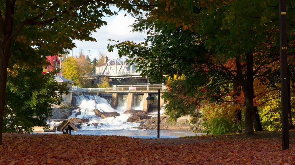
Beaumont Drive
Bracebridge
We recommend starting off this drive with a Muskoka Maple Buttertart from Beat the Wheat in downtown Bracebridge. Take your sweets and tour over the historic Bracebridge Falls and Silver Bridge, making your way to Beaumont Drive. If you are looking for a quick hike to check out a uncompromised Lake Muskoka vista – turn left on Stephen Bay Road, then right on Strawberry Bay Road to find Strawberry Point Trail (5km). Back on Beaumont Drive, meander the curves of the river to end up at Kirby’s Beach Park, where you can enjoy a picnic lunch, accessible beach and playground. Click here for a map of Bracebridge’s top driving roads